Posts Tagged ‘LCRA’

Central Texas Flooding: Worst May Be To Come

Thursday, October 18th, 2018

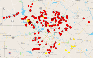
The worst flooding in the Austin area may still be to come:

The LCRA is now projecting that Lake Travis may rise to between 705-710 ft. elevation by Friday, approaching the all-time record crest of 710.4 ft. from Christmas, 1991.

Four flood gates are now open, and the LCRA says they may open four more Thursday, which would exceed the previous record of six open floodgates during a 1957 flood.

Additional rainfall is forecast through Thursday, with 1-2 inches possible, along with some isolated 4 inch totals. A Flash Flood Watch has been expanded from the Hill Country to the Austin metro area.

The LCRA is warning of serious flooding, and encouraging people to take precautions to protect life and property.

Eight open floodgates on Mansfield dam means eight open gates on Tom Miller damn just north of downtown Austin. Dont be surprised if you see a repeat of that “Steve Ray Vaughn Statue Flooded” pictures we saw during the 2013 flash floods.

Keep an eye on road closures, pay attention to the evacuation notices, and pack your bugout bag and be ready to go if you’re in low-lying areas or anywhere near the river.

Here’s late blues guitar legend John Campbell with “When the Levee Breaks”:

Update: LCRA says no additional floodgates need to be opened today: “LCRA will NOT need to open additional floodgates at Mansfield Dam today. It is still possible we will need to open up to four additional floodgates over the next few days.”

More information here.

Dangerous Flooding Along the Llano River

Tuesday, October 16th, 2018

If you hadn’t heard, heavy rains have caused serious flooding along the Llano river and the Texas hill country.

The Farm to Market 2900 bridge in Kingsland over Lake LBJ (just before the Llano and Colorado rivers meet) has collapsed:

Authorities have evacuated anyone within a quarter-mile of the river, including large portions of Marble Falls. The Lower Colorado River Authority opened the Mansfield and Tom Miller dams at noon.

Nor is the hazard limited to the river:

Williamson County conducted two water rescues because of flooding Tuesday morning. One was a vehicle in high water off CR 251 in Andice, and both people were transported to a local hospital.

The second was a school bus off CR 177 in Leander. The driver and one student on broad were rescued without injuries.

I would tell you to check the low water crossing map for the Austin area, but there’s no need: Every low water crossing in Austin is closed, flooded or on caution right now:

The cliched phrase of choice is there for a reason:

Pay attention to the evacuation notices, and pack your bugout bag and be ready to go if you’re in low-lying areas or anywhere near the river.

As for myself, I’m fine. The last time I looked at a topology map I was some 85′ higher than the Mansfield Dam spillway, so I’m safe unless we get a flood of Biblical proportion.